The debate on whether to carry paper maps or rely on mobile data is resolved when I find the SityTrails app. The app in combination with the ultra power saving modes on my Huawei P30, means the weight of the book/maps can be ditched. Plus every blog, guide or article I have read says the GR10 is very well waymarked. When I hiked the GR65 over two months I found the same, so I’m confident of not getting totally lost. That said I do still want a map as its the high Pyrenees, not rolling countryside of the GR65.
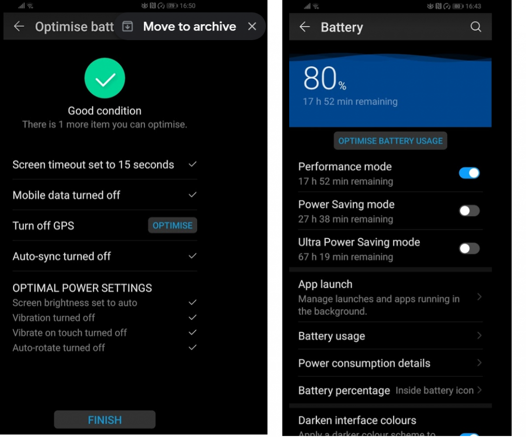
The P30 battery is pretty awesome. Screenshots below at 80% charged gives me a max extended battery life of 67 hours if the phone is left on around the clock, which it will not be, so can expect the 67 hours to be more like a 100 hours in practice. To further extend the battery the only apps running will be SityTrails and possibly the Kindle app which also has the The GR10 Trail: Through the French Pyrenees downloaded for offline reading. No mobile data, whatsapp, msgs, news notfiications, emails allowed (until I switch on to check). Below are the battery optimisation settings with GPS left on.
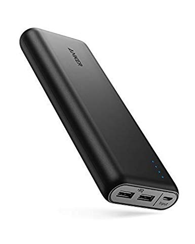
In addition to battery top ups when I am in civilization, I will also be relying on an the Anker PowerCore power bank to charge up in the mountains.
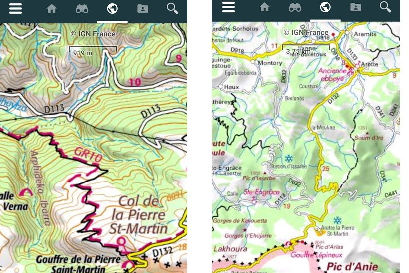
The above means I can ditch heavy guide books/maps and rely on SityTrails. Which based on limited use in Cambridge looks great. In addition to giving an exact GPS location against the trail (marked on the map), it also gives lat/longitude, altitude, total elevation climbed, uphill/downhill gradent (m), compass orientation, duration, current/average speed, distance covered and a nice graph off all the ups and downs. You can record your trail as you go and save the marked up map… nice but I will see how this impacts battery performance. Too much and I will only turn my mobile on for location spot checks.
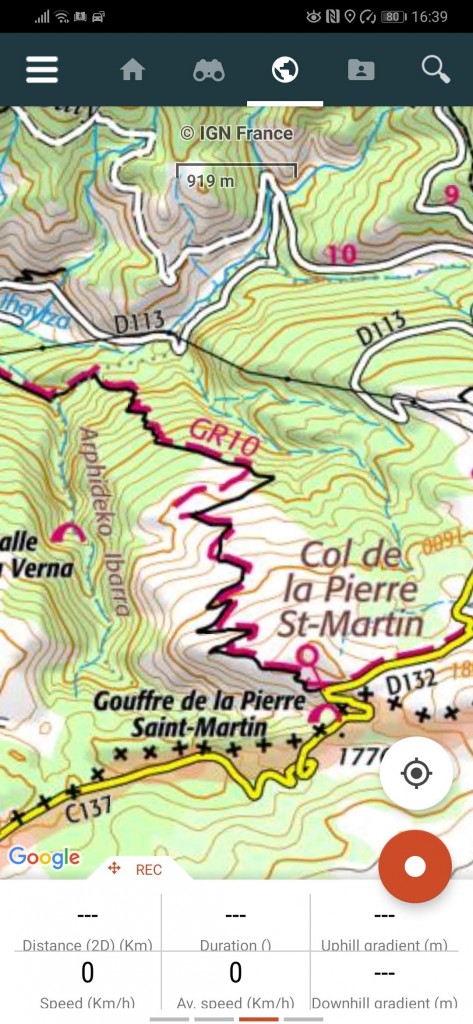
I could have used the free version, but paid 20 euros to get the French IGN topographical maps. It took a really long time to download the map onto my phone for use offline, which you definitely need to do. Allow a few hours to download over wifi.
Another bit of safety equipment, a small camp light, weighing in at 80g which has a setting to flash the 3 short/3 long SOS signal flashes.
French mountain rescue and emergency services number in France (112) is plugged into my phone should I need it.
And the last bit of emergency ‘kit’ – travel insurance. Which I rarely bother with, but this time I am getting some just in case I should need a helicopter mountain rescue (very expensive!), the policy allows trekking up to 4,600 metres as well as Via Ferrata type activity of which there is some in the Pyrenees but I am not planning on taking those routes!.
For digital maps I’d recommend the following apps:
Geoportail. This has everything you need for France
IGNrando. Similar to Geoportail, but you can load your own GPX tracks to it
OsmAnd. Again, you can load gpx data to it. (Elevation data was consistently wrong)
Googlemaps. Load your own gpx data to it and it helps if you are trying to locate accommodation etc en route. (Experimenting on the Alpe-Adria I found this showed my location more accurately than OsmAnd)
Outdooractive
My phone battery lasted far longer than my Garmin Oregon GPS, which would need a battery change after about 6 hours.